Virtual Surveyor v3.6.1
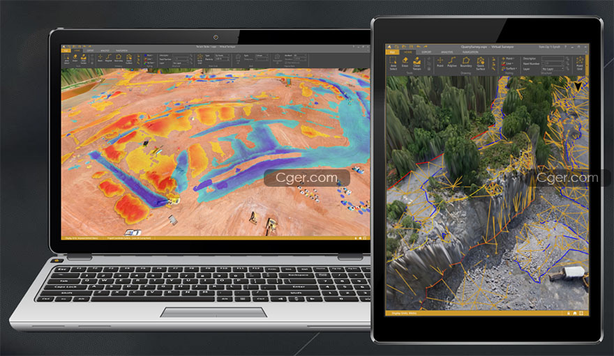
Virtual Surveyor是一个用于分析由航空摄影数据的摄影测量处理得到的地理空间数据和可视化程序。
使用该程序非常简单,不需要特殊技能。它允许您快速导入正交和高程地图(DTM),从而为用户提供一个交互式的三维环境。该程序允许在自动或半自动模式下手动和自动模式下建立三角网格。
该程序有一个方便的功能,可以按计算体积导出数据。程序的结果,取决于任务集,有三角剖分模型、结构线、DEM、3D模型。这些数据可以很容易地导出到CAD。程序中的工作清晰、直观、简单。适合广泛的用户,因为它允许您快速有效地解决大地测量和矿山测量任务。
Virtual Surveyor 是功能强大的无人机测绘软件,使用旨在为用户提供完整的地理空间数据可视化和分析功能,带来提高的生产力,功能全面而强大,在无人机到CAD模型的过程中,使用Virtual Surveyor软件来分析、测量体积并绘制断裂线!从您的无人机数据高效地创建调查,创建测量,表面和轮廓。跟踪您的Earthworks项目并进行相关的比较工作,创建切割/填充图并计算体积差异,通过更容易的方法来解释复杂的地形,利用强大的计算能力来创建您的调查,工作更加轻松,界面直观简单。

Virtual Surveyor is a user-friendly software designed for visualization and analysis of geospatial data obtained as a result of photogrammetric processing of aerial photography data. The program has been developed in Belgium since 2015, sold in more than 60 countries. Users: Topcon, Dyno Nobel, Daewoo and others.
Working with the program is quite easy and does not require special skills. It allows you to quickly import an orthomosaic and elevation map (DTM), resulting in an interactive 3D environment for the user. The program allows in automatic or semi-automatic mode to remove artifacts, trees and other objects unnecessary for the calculation; quickly and accurately calculate the volumes of dumps and warehouses of products, select the construction of the sole or upload to a file in * .dxf format previously removed for reliable calculation of volumes; carry out the necessary measurements and calculations; determine the coordinates of objects; create and edit hillshade, contour lines; build a triangulation network in manual and automatic mode. The program has a convenient function for exporting data by calculated volumes. The results of the program, depending on the tasks set, are a triangulation model, structural lines, DEM, 3D model. This data can be easily exported to CAD. The work in the program is clear, intuitive and simple. Suitable for a wide range of users, as it allows you to quickly and efficiently solve geodetic and mine surveying tasks.
描述:
标签: 地形 数据 测绘 航拍 软件分类:资源 > 软件资源 > 软件资源:未分类
发布:CGer | 查看: | 发表时间:2020/10/23 16:04:34 | 更新时间:2025/4/5 10:45:54
○ 因利息系统长期被人利用漏洞刷取CG点,目前取消利息功能,作为补偿,每个已存在账号额外一次性补偿当前余额的 30% ,后续充值赠送百分比提高 100% (10元+6%,20元+10%,50元+16%,100元+20%,200元+30%,暂定),请知悉。 ○ 充值或账号问题请【点击这里联系站长】 |
| 常见问题,点击查询: | ||
| ●CGer(Cg儿)资源下载帮助 | ||
| ●资源名词解释 | ||
| ●注册/登陆问题 | ||
| ●充值出错/修改密码/忘记密码 | ||
| ●充值赠送系统 | ||
| ●文件解压出错/解压密码 | ||
| ●Payment with Paypal | ||
| ●哪些资源会被列为付费资源 | ||
| ●为何要充值解锁 | ||
| ●免责条款 | ||
| ●联系站长(联系站长前请先仔细阅读 免责条款 ,网站只提供资源,不提供软件安装等服务!) | ||


