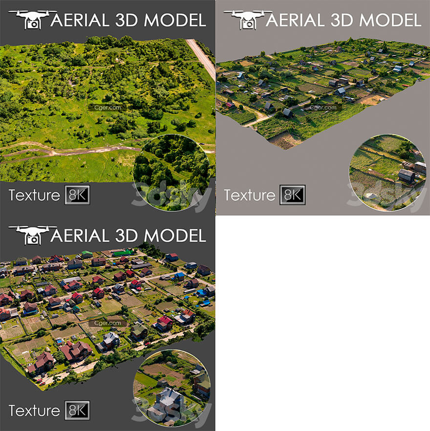
3组3dsky网站的航拍扫描的地形Pro模型合集。
使用直升机对地形进行了3D扫描。适用于作为背景填充的总体规划可视化。该模型是在真实照片的基础上制作的,包含景观的许多细节和特征。
我建议使用 Slice 修改器编辑模型,以便您可以将模型修剪到所需的区域。
仅用于长期计划作为预览。
标签
空中扫描, 扫描, 外观, 总体规划, 城市, 房屋, 区域, 建造, 森林, 草坪, 道路

Aerial scan 8
Aerial scan 10
Aerial scan 16
A 3D scan of the terrain was made using a quadrocopter at an altitude of 60 m.
The model consists of one Edit Poli with 1 texture scan.
Texture (scan) 8192x8192
Suitable for visualization of master plans as a background fill. The model is made on the basis of real photos and contains many details and features of the landscape.
I recommend editing the model with the Slice modifier, so you can trim the model to the desired areas.
Use only for long-range plans as a preview.
tags
aerial scan, scan, exterior, general plan, city, houses, area, building, forest, lawn, road
描述:
标签: 室外 鸟瞰 地形 场景 航拍分类:资源 > 3D资源 > 3dsky/3ddd
发布:CGer | 查看: | 发表时间:2022/11/14 17:30:53 | 更新时间:2025/4/5 11:28:02
○ 因利息系统长期被人利用漏洞刷取CG点,目前取消利息功能,作为补偿,每个已存在账号额外一次性补偿当前余额的 30% ,后续充值赠送百分比提高 100% (10元+6%,20元+10%,50元+16%,100元+20%,200元+30%,暂定),请知悉。 ○ 充值或账号问题请【点击这里联系站长】 |
—————————————————————————————————————————————— | ||
| 哪些资源会被列为付费资源? ●站长付费购买的资源,站长从其他途径付费购买的资源。 ●资源包体积巨大,需要大量时间上传,占用大量存储空间的资源。(目前超过10GB的资源可能会列为付费资源) ●内容经常被某些人倒卖并恶意举报的资源,收费可以减少恶意举报的概率。 ●稀少的和高质量的资源。 |
| 常见问题,点击查询: | ||
| ●CGer(Cg儿)资源下载帮助 | ||
| ●资源名词解释 | ||
| ●注册/登陆问题 | ||
| ●充值出错/修改密码/忘记密码 | ||
| ●充值赠送系统 | ||
| ●文件解压出错/解压密码 | ||
| ●Payment with Paypal | ||
| ●哪些资源会被列为付费资源 | ||
| ●为何要充值解锁 | ||
| ●免责条款 | ||
| ●联系站长(联系站长前请先仔细阅读 免责条款 ,网站只提供资源,不提供软件安装等服务!) | ||
-

网站置顶/公示帖集合
25 0 0
资源 > 3D资源 > 3dsky/3ddd
-

网站置顶/公示帖集合
38 0 0
资源 > 3D资源 > 3dsky/3ddd
-

网站置顶/公示帖集合
21 0 0
资源 > 3D资源 > 3dsky/3ddd


